|
Seest
thou not how thy Lord dealt with the 'Ad (people),- Of
the (city of) Iram, with lofty pillars, The like of
which were not produced in (all) the land? (The Holy
Qur'an: Surat al-Fajr, 6-8)
The tale of the lost city of Ubar has for centuries been
one of the Middle East’s greatest mysteries. Subject of
countless Bedouin tales, Ubar was even mentioned in
The One Thousand and One Nights, while Lawrence of
Arabia called it "the Atlantis of the Sands". Most
importantly, there is a reference to the city in the
Holy Quran where, due to its imposing architecture, Ubar
was referred to as Irem That Al Emad, the "city of
towers".
The legend goes like this …
Buried under the sands for centuries on end, Ubar was
once a city bustling with life. King Shadad of the
ancient civilization of Ad built the city some five
millennia ago and it quickly became a thriving
commercial centre. The secret to Ubar’s prosperity was
frankincense – a commodity as precious as gold in the
ancient world. Prepared from the sap of trees grown in
the nearby Qara Mountains, this sweet-smelling substance
was widely used in religious offerings, cremations and
imperial processions, while both nobles and commoners
alike coveted it for its medicinal benefits. So popular
was frankincense with the ancient people, that even the
Queen of Sheba is said to have frequented the Ubar
region for supplies of the precious substance, which she
then offered to King Solomon.
As
the sap’s fame grew around the world, so did Ubar’s
fortunes. Believed to have been one of the main points
on the frankincense route, the city saw caravans
transporting shipments of the sap to Alexandria,
Jerusalem, Damascus, Rome, and China. In Ubar’s time the
trade in frankincense was as important to the world as
the trade in silk from the Orient would be a millennium
later. Ironically, it was the city’s immense wealth that
was to bring about its tragic end.
According to the Holy Quran, King Shaddad did not spare
gold, silver, pearls, amber and other precious
commodities when building the city as he was trying to
recreate his idea of paradise. The city and the roads
that lead to it were left crumbled and buried beneath
the sands of the desert when God destroyed the
corruption of wealth and delights of the flesh of the
people of Ad.
Searching for the lost city
For centuries on end the mystery of Ubar has captivated
the minds of archeologists and explorers. There were
several documented expeditions devoted to the search of
the city. One of the first attempts was in the 1930s and
belongs to British explorer Bertram Thomas. The first
documented Westerner to cross the Rub’al Khali in a
series of expeditions in 1925 – 1932, Thomas found
evidence of a caravan route across the desert as well as
remains of pottery along the route, but this was all as
he was overwhelmed by the desert’s harsh conditions. The
great Lawrence of Arabia also dreamt of finding the
great city, but was unsuccessful.
In
the 1950s, an expedition lead by American archaeologist
Wendell Phillips managed to find Thomas’ caravan route
but could not find the city itself among the vast sea of
sand dunes.
Ironically, it was an amateur US archaeologist that
solved the mystery of the lost city. An award-winning
filmmaker for Disney, the National Geographic Society
and Columbia Pictures, Clapp had been on previous
exhibitions to discover Ubar. In the early 1980s, after
careful reviews of ancient maps, literature and other
records, he arrived at the conclusion that Ubar was
located in southern Oman. However, the search needed to
be narrowed as this area spreads to hundreds of
kilometers. This is where modern technology came to the
rescue.
Remote sensing technology helps
The idea of narrowing down a search area before
investing money and effort in a major excavation job is
not foreign to archaeology. As early as the beginning of
the 20th century, archaeologists were taking
aerial pictures of historical sites and the first such
site was the Stonehenge in England.
From those early aerial pictures evolved a new method
that allows scientists to analyse the surface of the
planet and distinguish topographical features often
unperceivable by the human eye. Remote sensing
technology involves the use of satellites equipped with
special sensors who record the various electromagnetic
waves emitted from the Earth. This information is then
fed to networks of powerful computers which process it
thus allowing scientists to see from space what is often
invisible on the ground and pinpoint archaeological
sites.
Having formulated a general assumption of the area where
Ubar probably was, Clapp approached Dr. Ronald Bloom at
the National Aeronautics and Space Administration (NASA)
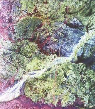
in the US. A technology known as radar imaging was used
to study the Southern Omani desert. Radar imaging is
generally very useful when surveying arid regions as the
radar can penetrate through dry sand. Clapp and Bloom
hoped the radar will let them ‘see’ through the sand the
remains of the ancient Ubar fortress. However, this
method did not yield the expected results.
When the initial radar images proved unhelpful in
finding the location of the lost city, another remote
sensing method came to the rescue. Equipped with a
powerful appliance called the ’thematic mapper’, the
Landsat satellite brings out topographical features not
discernible to the human eye. Data from Landsat was
combined with data from a French satellite know as SPOT
and this allowed Clapp and Bloom to narrow down their
search, eliminating vast areas in the desert. In the
end, the researchers found a series of tracks across the
desert, which they identified as ancient caravan routes.
The spot where the routes converged was some 180
kilometres north of the city of Salalah, near the small
town of Shisr on the verge of the Empty Quarter.
What lay beneath the sands?
After two expeditions in 1990 and 1991, excavations
began near Shisr on Christmas 1991. Besides Clapp and
Bloom, the expeditions also consisted of American
archaeologist Juris Zarins and British explorer Sir
Ranulph Fiennes. Famous for being the first man to visit
both the North and South poles, Fiennes had attended
previous searches for Ubar. US litigator and avid
explorer of modern-day Oman and Yemen, George R. Hedges
was leader of the expedition.
What was discovered beneath the sands was to make
front-page news around the world and was later named one
of the ten most important discoveries of the year by
Discover, Time and Newsweek magazines.

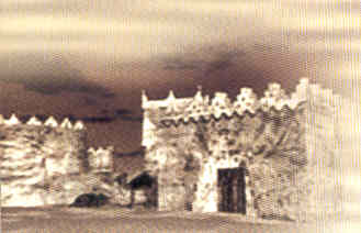
The excavations uncovered a 90-centimetre thick fortress
wall constructed of large limestone blocks. The fortress
had the form of a pentagon and boasted a commanding view
over the surrounding countryside. The remains of eight
once imposing towers were clearly distinguishable. There
was an ancient well, which must have supplied the
settlement with water. The thickness of the fortress’
walls most probably means the city within it was very
well-off. As the city was a major hub for the
frankincense trade, there must have been a lot of money
kept there and the walls were a deterrent to thieves
from outside the city. The walls were also meant to
protect the city’s water supply as water was not freely
available in the area.
On
the site, the group of scientists also found glass
vessels and incense burners, dating back to the era
between 1000 BC and the Islamic era 900-1400 AD, as well
as pieces of Greek, Roman and Syrian pottery, the oldest
of which was more than 4,000 years old. The discovery of
artifacts from places as distinct as the above could
mean only one thing – the settlement was a major trade
centre.
Pieces of frankincense were also found at the excavation
site. It seems the city was surrounded by storage
facilities where vats containing the precious commodity
were kept. Also around the fortress, spreading out as
far as six miles into the desert, were a large number of
little campsites and villages. These were used as
resting points for the many caravans traveling across
the region. He view from the fortress of Ubar probably
revealed a sea of the tents and campfires of the
frankincense traders.
The presence of frankincense storage facilities and
foreign artifacts made scientists believe that the
fortress most probably was the lost city of Ubar.
Another point that suggests this is the fact that the
fortress appears to have indeed met a tragic end. It
turned out that the walls of the fortress had been
constructed over a giant limestone cavern. The cavern
had collapsed, destroying the fortress and burying the
city beneath the sands.
 The
expedition managed to collect evidence revealing how the
ancient people of Ubar lived. It turns out they were
growing barley and dates, plants traditional to the
area. Farming was possible by the presence of water,
which they used for irrigation. From remains of bones
found at the site, the scientists discovered that the
ancient inhabitants of the fortress raised domestic
animals, while fish from the Indian was also a part of
the ancient’s daily menu. Surprisingly enough, it turned
out the Ubarites were probably trading in horses as well
as in frankincense. The
expedition managed to collect evidence revealing how the
ancient people of Ubar lived. It turns out they were
growing barley and dates, plants traditional to the
area. Farming was possible by the presence of water,
which they used for irrigation. From remains of bones
found at the site, the scientists discovered that the
ancient inhabitants of the fortress raised domestic
animals, while fish from the Indian was also a part of
the ancient’s daily menu. Surprisingly enough, it turned
out the Ubarites were probably trading in horses as well
as in frankincense.
Ubar seems to have been more than just a city. According
to Zarins, the name ‘Ubar’, as mentioned in the
classical texts and Arab historical sources, was used to
refer to a region and a group of people. References to
Ubar as a city are only found in later, medieval
versions of The One Thousand and One Nights. The
city of Ubar was one of three or four major centres of a
kingdom in the area, which spread as far as parts of
modern-day Yemen.
Ubar – a link to the past
The discovery of
the city of Ubar had big implications for people in the
Arabian Peninsula and beyond. The story of the lost
city, which was miraculously found from beneath the
sands, was picked up from media from all over the world
and helped raise awareness of what the Sultanate of Oman
had to offer.
For archaeologists, the era after Ubar brought a new
appreciation of the ancient past of the Arabian region.
The discovery of the city led to three more years of
excavation in the region and during this time the
scientists managed to pinpoint a number of sites, which
were all linked to Ubar and the frankincense trade. A
major discovery was the city of Saffara Metropolis on
the coast of Oman, which has been mentioned in ancient
Roman maps. In 1997, Zarins and Hedges took to Yemen in
an attempt to unravel more secrets of the ancient
frankincense route. They started excavating in the
region of Al Mahra, where they discovered more than 60
archaeological sites in less then a month. A year later,
the scientists set off to Yemen’s coastline. They were
able to confirm that frankincense also grew in
modern-day Yemen and that there was a link between
territories there and Ubar. It seems that Zarins and his
colleagues are not yet finished and there are many more
fascinating discoveries yet to come.
| 